white_hart: (Default)
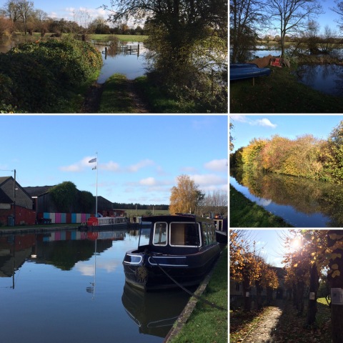
We were going to go for a longer walk today, but it rained heavily again last night and we we worried that anything involving paths across fields would be a long, squelchy slog, so we decided to stick closer to home and just walked along the canal and through the nature reserve to Sainsbury's again.

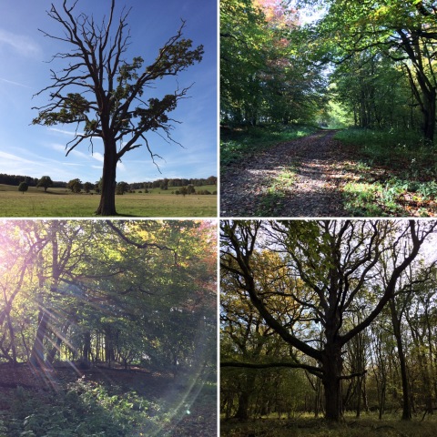
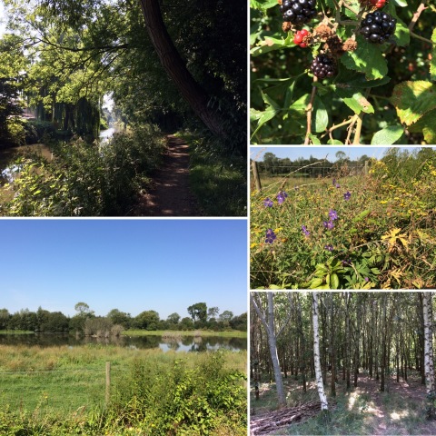
Images from walk on 15/12/19

It was a lot muddier than it was last weekend, but we knew that the only really squelchy bit of the walk would be the first bit after crossing the canal into the nature reserve, and that's only 100m or so. The forecast showers held off, and we saw a pheasant flying across the canal and a red kite flapping low over the path as we walked through the woods (I'm always surprised by just how big they are close to). It's only a short walk (just over two and a half miles) but it was good to get out in the fresh air for a bit.
white_hart: (Default)
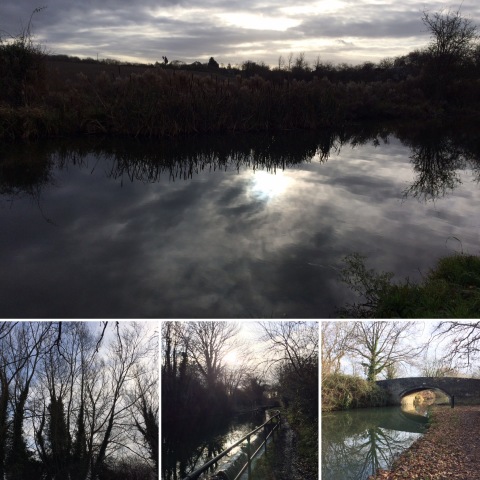
No long walk this weekend, but I managed two shorter walks along the canal towpath.

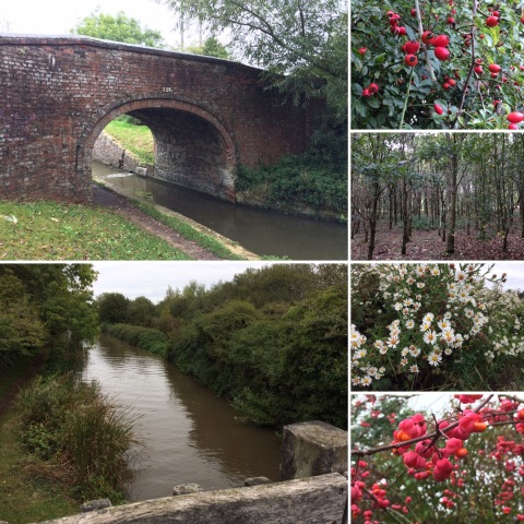
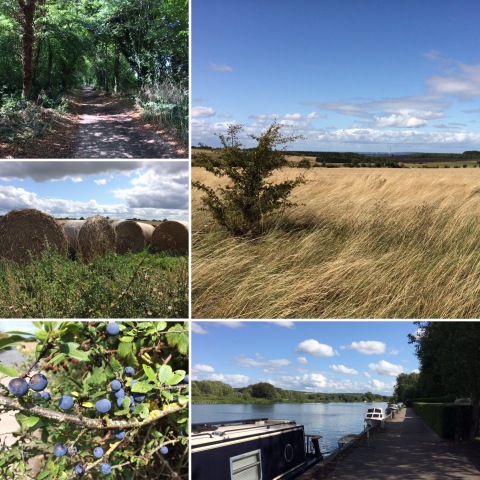
Images from walk on 07-12-19

T was out yesterday, and although the weather wasn't brilliant I thought it would do me good to get outside, so I decided to go for a walk along the canal to buy myself something for dinner. When I set off, I wasn't sure whether I wanted to walk to Sainsbury's in Kidlington or all the way to M&S in Summertown, but by the time I reached the bridge I'd need to cross to get into the nature reserve on the way to Sainsbury's I was enjoying walking far too much not to carry on to Summertown. The rain held off, and the gleams of sunshine filtering through the cloud cover and reflecting off the water gave everything a wonderfully moody, atmospheric look. Unfortunately, when I got to Wolvercote I discovered that the towpath was closed between there and Jericho for major works. It looked as though they were making it wider and flatter and gravelled, as it is nearer the centre of Oxford, rather than narrow and uneven and muddy as it is further north. I can see the point, as it is quite heavily used, by cyclists as well as walkers and runners, but the vegetation along the banks is so glorious in summer I hope they aren't planning to extend this any further north.

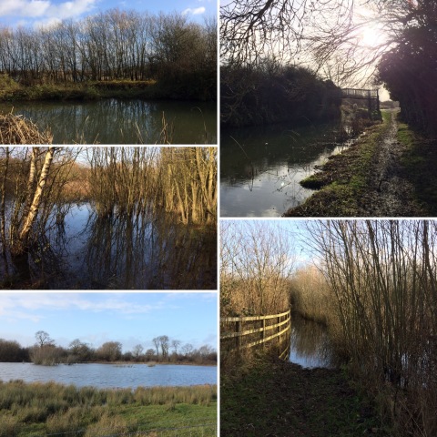
In any case, the closure meant that although I walked just under five miles, the last mile and a bit was on roads rather than towpath, and when it was sunny this morning I decided to go for another walk, to Sainsbury's this time.

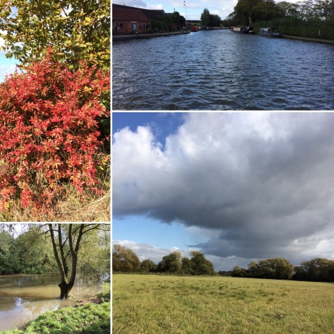
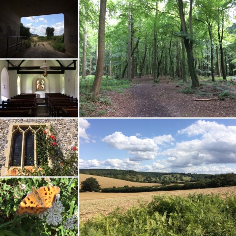
Images from walk on 08-12-19

The nature reserve was muddy but was rather lovely under blue skies. I bumped into my next-door neighbour bird-watching by the pond and she pointed out the heron I'd otherwise have mistaken for another tree-stump on the island in the middle, and told me all the different species of ducks she'd spotted through her binoculars. And I'm sure it's done me good to get a reasonable amount of time outdoors and mostly away from roads and houses this weekend.
white_hart: (Default)
We took advantage of the first sunny Sunday in weeks to get out for a proper walk, and picked one from our Ordnance Survey book of walks that we hadn't done before, over and around Boar's Hill from Wootton.

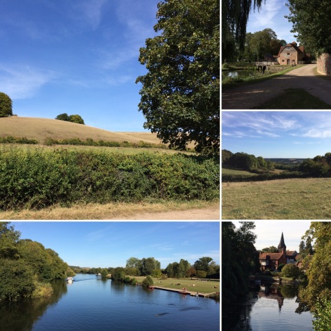
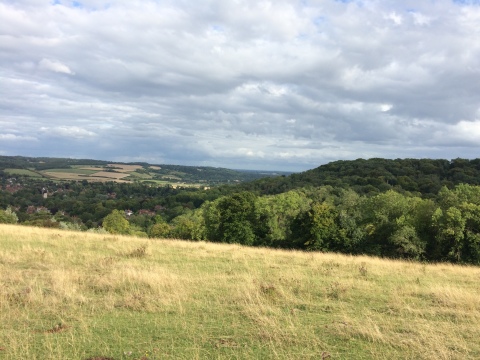
Images from walk on 01-12-19

Although it was only just over four and a half miles, it took us just over two hours, as it was very muddy in places and that made it slow going. It also turned out not to be an entirely satisfactory route as very little of it really felt like being out in the countryside. After crossing some fields via a very large number of stiles (the fields had been subdivided into smaller paddocks for individual horses, with temporary stiles at each boundary) we walked up through the village of Old Boar's Hill to Jarn Mound. After climbing the mound (from which there still isn't much of a view even now the trees have mostly lost their leaves), we walked through the wild garden which has houses backing on to it, and then along a road past the old OU building before turning into the meadows on the eastern slopes of Boar's Hill. Once we moved away from the road this section crossed fields with no houses or roads in sight, but it wasn't very long before we reached Chilswell Farm and climbed back up Boar's Hill, passing the Carmelite Priory and Youlbury scout camp and crossing into one last small section of meadow before a longish stretch of road back to the car in Wootton. I'm sure that some people would enjoy looking at the grand houses of Boar's Hill, but I just felt a bit cheated of open country. Not a walking route I'd do again.
white_hart: (Default)
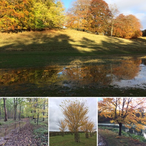
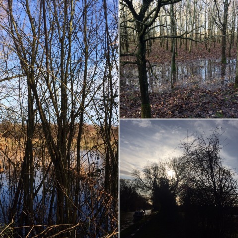
After yet more heavy rain yesterday, today is a crisp, sunny autumn day, and we thought we'd walk along the canal to Shipton-on-Cherwell and then back across the fields via Hampton Gay and Hampton Poyle. Unfortunately, as the top left image below shows, when we got to Shipton-on-Cherwell we realised that the path across the fields was under rather a lot of water.

Images from walk on 101119

There didn't seem to be anything to do but to loop back past the church in Shipton-on-Cherwell and home again the way we'd come along the canal from Thrupp. Still, it was lovely along the canal today, and we still managed just under four miles in the fresh air and sunshine, which is better than nothing.
white_hart: (Default)
Yesterday was another day of heavy rain, but this morning it had at least stopped raining, even if if was still overcast and gloomy, so we decided to risk heading out for a walk. Given how wet it's been, it seemed sensible to go somewhere with good paths, and decided to try Blenheim Park (the palace and formal gardens cost an arm and a leg to visit, but a lot of the path is open to the public free of charge). The last time we visited we parked in Combe, but that involved crossing a very muddy field to get to the park gate; this time, we parked in the main car park in Woodstock and walked across fields on a path with hollyhocks on either side to join the Oxfordshire Way where it follows a minor road near Wootton, and followed it up to enter the park by the Oxfordshire Way gate towards the north-east corner.

Images from walk on 03-11-19

We carried on along the Oxfordshire Way to the other side of the park, then headed south towards the palace and the lovely hilly section near the lake. The clouds started to break up around the time we came into the park and by the time we got to the lakeside path there was blue sky and glorious autumn sunshine. Although the park was busy the real crowds were on the tarmac drives and the lakeside path was surprisingly quiet. Reaching the bridge in front of the palace, we walked up the hill to the monument and then, after pausing to admire the view, back down to join the path leading back to the gate near the bridge over the River Glyme in Woodstock. In the past, I've found Blenheim Park a bit dull, but this walk seemed to cover the more interesting bits, and mostly stayed away from the really busy paths; I liked it a lot and will definitely do this route again.
white_hart: (Default)
I've been struggling lately, for a variety of reasons. Partly it's because work has been ridiculously busy; I've been working longer hours than I can really manage on more than a very occasional basis, and have been left exhausted and drained as a result, with no prospect of much of a let-up in sight. Partly it's because the nights are drawing in and my brain doesn't respond well to the reduction in daylight. And partly it's because the weather has been wet and grey and miserable and we haven't managed to get out for a Sunday walk in weeks, and I've missed being outdoors and spending time in nature.

Happily, today was actually sunny. I felt the need of some hill-climbing, or what passes for hill-climbing round here, so we drove over to Wytham and walked a five-mile circuit in the woods.

Images from walk on 271019

Lots of other people had obviously had the same idea, and it was busy enough that the main car park was full and we had to park in the overflow, but after we'd walked down into the village we left them behind and headed along the path towards Botley in glorious solitude. The climb from Botley car park to the viewpoint at the top of the hill proved to be just what I needed, and by the time we got to the top I felt more human than I had done in weeks. It got busy again as we got back towards the car park, but following a side path rather than the main paved track got us away from people again. Sometimes I find the woods a bit dull and wish I'd picked a more varied walk, but today they were absolutely delightful.
white_hart: (Default)
Work has been A Lot recently, and yesterday I wanted nothing more than to run away to the seaside. Unfortunately, we live a long way from the seaside; T was busy and I wasn't feeling up to driving nearly a hundred miles each way without a navigator, while public transport would have taken a long time and could only really offer Bournemouth or Southsea, neither of which seemed likely to be quite the kind of lonely windswept shingly expanse I was craving. Also, even though it was the weekend I really needed to do some work, so I contented myself with a wander down the canal and through the nature reserve, picking blackberries as I went (even though it's October now and they are starting to wither I managed to fill a 900ml lidded plastic "soup mug").

Images from walk on 051019

The forecast for today hadn't looked optimistic, which is one of the reasons I was so keen to get out yesterday after a couple of weekends of it being too wet to walk, but in fact it was blustery but dry and mostly sunny, and we walked the other way up the canal to Thrupp and Shipton-on-Cherwell and back through the woods.

Images from walk on 061019

Going through the woods, rather than round by Hampton Gay and Hampton Poyle, might not have been the best choice, because despite the dry summer the recent heavy rain had left the paths very muddy in places, but I do like the bit along the Cherwell (which was much higher than usual), and the views across St Mary's Fields coming back into Kidlington. We picked another soup mug full of blackberries on the way up the canal towpath and stopped off at Tesco's on the way back through Kidlington for custard.
white_hart: (Default)
We may be back from our long-distance walk, but down south the weather is still warm and summery and it would have been a shame not to make the most of it by going for a walk today. We picked one of the slightly shorter walks we'd rejected over the summer as not quite long enough to be good practice for Scotland, though at 8.25 miles today's only just didn't make the grade (and in fact it turned out to be more like 9.25 miles as we had to divert slightly at the end to avoid walking down a busy road which the book swore had a footpath, but if so it was in stealth mode).

Images from walk on 150919

The walk we chose started in Pangbourne, on the Berkshire side of the Thames, but in fact Pangbourne only seemed to have been chosen as a starting point because of the availability of car parking. Having managed to find our way to Pangbourne despite the best efforts of Google maps, which appears to have something against the A329 and instead sent us down a tiny road with lots of very narrow bits and across Whitchurch toll bridge, we immediately crossed back over the toll bridge (fortunately there are no tolls for pedestrians) to the Oxfordshire side and walked from Whitchurch-on-Thames to Mapledurham (a typical Oxfordshire Chilterns village whose greatest claim to fame is probably pretending to be a village in Norfolk in the film The Eagle Had Landed), passing Hardwick House on the way (something which surprised us both, as neither of us had realised Hardwick House was in Oxfordshire), as well as fields full of alpacas and horses. We then returned to Whitchurch by a different path, further from the river and climbing up and down through beechwoods and across grassy Chiltern slopes. The weather was glorious, with enough of a breeze to stop it from being too hot, though as after a few weeks away I've clearly lost my getting-ready-for-a-walk-routine and had managed to leave my sunhat at home I was quite glad of the shady parts too. We also passed lots of bushes absolutely laden with ripe blackberries and picked enough for a crumble for pudding tonight, though we could have picked more if we'd had more plastic bags with us.
white_hart: (Default)
For our holiday this year, we decided to pick up where we left off in Fort William and walk the Great Glen Way to Inverness, following the Caledonian Canal and the shores of Loch Lochy, Loch Oich and - for the whole of the second half of the walk - Loch Ness. There appears to be some confusion about how long the Way actually is, with some websites saying 79 miles and some saying 73; in total, we walked 74.75 miles as measured by Runkeeper, though that included some additional distance getting to and from our B&Bs and our finish was a couple of miles short of the "official" finish.

ExpandDay 1: Fort William to Spean Bridge )

ExpandDay 2: Gairlochy to Laggan )

ExpandDay 3: Laggan to Fort Augustus )

ExpandDay 4: Fort Augustus to Invermoriston )

ExpandDay 5: Invermoriston to Drumnadrochit )

ExpandDay 6: Drumnadrochit to Inverness )

Overall, I think I preferred the Great Glen Way to the West Highland Way. The WHW was absolutely at the limits of our capacity as walkers, leaving us both feeling absolutely done in, whereas the GGW was well within our capabilities, and generally seemed to have better paths (the stoniness of so much of the WHW was a big part of what made it feel like such hard going), so that we still had enough energy left to enjoy the rest of our holiday (a day in Inverness and then a weekend in Glasgow), rather than just wanting to sleep. The GGW was also much, much quieter, with long periods where we didn't see anybody else, whereas the WHW is so popular that there was almost never a moment when we couldn't see at least a couple of other walkers ahead or behind us. However, as the trail itself goes through less sparsely populated areas we found better food along the way; on the WHW it was basically standard pub grub, and by the time we got to Fort William I was desperate for a dinner that didn't involve chips, whereas on the GGW there was a lot more choice and despite mostly sticking to my resolution to be pescetarian whenever I have a choice about what I eat (the exception being a slow-cooked lamb shank in Invermoriston, which was the only thing that seemed hearty enough when I'd spent the day being so cold and wet) I only had macaroni cheese and chips once. (Which is actually a little sad, as I do love macaroni cheese and chips and English pubs don't do it.) The weather did nearly defeat us (after getting soaked to the skin despite waterproofs a second time, I swore that if we had another day of heavy rain like that I was just going to get the bus; fortunately, the remaining two days were better), but you can't control the weather and people did keep telling us what an incredibly wet August they'd had (and even down in Glasgow the rivers were clearly very full).
white_hart: (Default)
We had a longer walk planned for today, but then the weather forecast changed and instead of the temperatures dropping to the mid-20s it's supposed to get up to 30 degrees again, and walking thirteen and a half miles in 30-degree heat didn't sound either fun or particualarly sensible, so instead we just walked to Sainsbury's via the canal towpath and nature reserve.

Images from walk on 260819

Even at 10am the heat was a bit much, though there was plenty of shade along the route which meant it didn't feel too bad. We decided not to walk back home after doing our shopping, as that's mostly along roads and paths through the housing estates, with a lot less shade. I am a bit sad not to have got one last long walk in before we head up to Scotland on Wednesday, but we have done plenty of walking this summer (we clocked up nearly 100 miles in July) and I don't think heat exhaustion is actually good preparation for a 78-mile, 6-day walk.
white_hart: (Default)
Having finished the Oxfordshire Way, this weekend was back to normal with a 10.5-mile circular walk. This one was from the Ordnance Survey book of circular walks in the Thames Valley and Chilterns, starting at a National Trust car park just outside Streatley and heading out across the Berkshire Downs on the Ridgeway before turning back to reach the Thames Path at Moulsford and following that back to Streatley.

Images from walk on 180819

It's strange how different the Downs are to the Chilterns on the other side of the river; instead of the Chiltern beechwoods, the Downs are mostly fields, and where there are woods they're generally mixed rather than beech. Because they're much more open, they can be quite windswept on a breezy day. Today's walk mostly took us along byways rather than footpaths or bridleways, which meant being passed by occasional Landrovers or dirt bikes, and towards the end of the Downs section we also passed a field where there was a motocross event going on, rather noisily, though the earlier part of the walk was very peaceful and the views were glorious (although the absence of the Didcot Power Station cooling towers was rather odd!).

The walk directions made some slightly odd choices, one of which was directing us a short distance down the verge of a fairly busy A-road to join the path to Moulsford, when looking at the map clearly showed that there was a path doubling back downhill just before the byway we were on joined the road and meeting the path we wanted to be on, so we would only have had to cross the road and not walk along it (though it turned out to be possible to get down off the verge into the field margin, which felt a lot safer).

The section of the Thames Path from Moulsford to Streatley turned out to be a particularly pleasant one, and we stopped for a drink and some crisps at the pub in Streatley before tackling the final steep climb up to the car park, for which we were rewarded with a terrific view over the Goring Gap, where the Thames cuts through the chalk to divide the Berkshire Downs from the Chilterns.

View of Goring Gap from Lardon Chase

Again, this was a point where the book seemed rather odd, mentioning the route we took as an alternative "scenic route" but suggesting that the standard route back to the car park was along the road, which was a moderately busy B-road with no pavements and which climbed fairly steeply, if not as steeply as the path; having driven up it to park, I certainly wasn't going to try walking up it!

All in all, I don't think I liked this walk as much as some we've done, but it had some very pleasant stretches and I probably would do it again at some point.
white_hart: (Default)
I had the day off yesterday, and the weather forecast was good, so we took the opportunity to finish the Oxfordshire Way, returning via Lewknor and the Ridgeway to follow the trail up into the Chilterns at Christmas Common and then through wooded hills to descend to the Thames at Henley, twelve and a half miles in total.

Images from walk on 130819

It was a lovely day, sunny but not as hot as it was when we walked the last stage, and this is a really delightful stretch of path. A lot of it runs through beechwoods, interspersed with fields and occasional flint-and-brick villages. It may not have been as long as some of the sections we've done, but it was definitely the hilliest section, with three major climbs and corresponding descents, and quite steep in places. We stopped for lunch by the preetty little flint church at Pishill (pronounced, I gather, Pies'll), because if there's one thing that I've learnt from all this walking is that if you're in England and want a bench to eat your sandwiches on you're almost certain to find one in a churchyard. Pishill Church was particularly well-equipped, possessing not only a choice of benches but a kettle, mugs and tea and coffee left in the porch for the benefit of thirsty walkers, along with rather good flapjack in return for a suggested donation of 50p per piece. (I'd say "most C of E thing ever", except that on Sunday we went to see the helter-skelter in Norwich Cathedral.) After Pishill, we climbed the hill at Maidensgrove and then descended via the Warburg Nature Reserve to a stretch of road-walking before a final climb from Middle Assendon to cross Henley Park and head down to the town and river.

The end of the Oxfordshire Way isn't commemorated with a plaque or obelisk as better-known trails are; I think the last (or first, depending on your direction) sign is the one pointing off a road on the outskirts of Henley along the path to Henley Park. I don't think it's ever going to be a destination walk, and I probably wouldn't revisit the middle sections, but it's been lovely getting to know Oxfordshire a bit better and the first and last couple of sections were delightful. I wouldn't redo yesterday's walk as a linear walk, but that was mainly because of the awkwardness of the transport links that way; having to get the bus into Oxford and then all the way out again via Headington to Lewknor meant that it took us an hour and a half to get to the start, and the same again to get back via the two changes needed to get from Henley to Oxford by train. I would absolutely do a circular walk on the same paths, though, and as our book of adventurous walks includes one which starts and finishes in Christmas Common and returns via the Oxfordshire Way from Maidensgrove via Pishill, I suspect we definitely will.
white_hart: (Default)
I had today off work as well, so we walked the fifth (and penultimate) stage of the Oxfordshire Way; ten and a half miles from where we left off in Tiddington to the junction with the Ridgeway near Watlington, plus another two and a bit miles down the Ridgeway to Lewknor Turn to pick up the Oxford Tube back to Thornhill park and ride where we'd left the car to save having to travel into Oxford and out again both ways.

Images from walk on 290719

It was a glorious sunny day, but still much cooler than last week with temperatures in the mid-20s and a bit of a breeze. This section was much more interesting than the last couple; although we stopped just short of climbing up into the Chilterns proper, for most of the day we were walking through a gently undulating landscape that seemed to have a clear kinship with the hills ahead. After climbing out of Tiddington through fields (including one with a sign warning of the presence of a bull, though the only animal visible was a black and white cat) we walked through the woods of the Rycote estate and crossed a golf course before descending to the village of Tetsworth and crossing under the M40, then crossing more fields and following a long tree-lined lane into Pyrton. About a mile and half south of Pyrton we turned on to the Ridgeway, which at this point actually turned out to run along the bottom of the Chiltern escarpment, rather than the top. It was a particularly pleasant section, mostly through beech woods (whose shade was very welcome by that point), emerging into open fields as it neared the motorway where we turned downhill again to reach the bus stop.

Unlike the last section, this is one I'd happily walk again, and in fact the public transport links make it very easy (in particular, the trip from Lewknor back to Thornhill is incredibly quick). I'm also looking forward to the next and final section through the Chilterns to reach the Thames at Henley, although the public transport back from that is less good (changes at Twyford and Reading).
white_hart: (Default)
I had the day off work yesterday, and as it was significantly cooler than it had been for the rest of the week (though still quite warm) we decided to tackle the next stage of the Oxfordshire Way, retracing our steps to Islip and then following the Way through Beckley and Waterperry to Tiddington, which straddles the Oxford-Thame-Aylesbury Road and is served by the 280 Oxford-Aylesbury bus which we could catch back to Oxford.

Images from walk on 270719

This and the Kirtlington-Islip section are probably the least interesting bits of the Oxfordshire Way, mostly running across the flattish farmland of the floodplains of the northern Thames tributaries in between the interesting hilly bits of the Cotswolds and Chilterns. The most interesting bit of yesterday's walk was probably the bit around Beckley, where the path crosses the northern end of the low ridge of hills to the east of Oxford (Forest Hill, Shotover, Garsington Hill, Cuddesdon Hill, part of the same lowish ridge that Cumnor Hill, Boar's Hill and Wytham Hill to the west belong to, as well as Folly Hill in Faringdon and Brill just over the Buckinghamshire border; you can see it quite clearly on this topographic map if that's the sort of thing that interests you) with lovely views from either side of the ridge; before that we skirted the Otmoor RSPB reserve, where we didn't see any birds but did see absolute clouds of meadow brown butterflies. After descending the hill from Beckley the rest of the walk was almost entirely flat fields; pleasant enough, but a little dull.

As there wasn't a convenient village to stop in for lunch on this leg of the walk (Beckley was a bit too close to the start, and then we didn't go through any settlements at all until we got to Waterperry, only a couple of miles from the end) we paused to eat our sandwiches in a small wood near Horton-cum-Studley where we spotted three fallow deer grazing on the path. Shortly after this we met a man walking the other way who warned us that he had been chased by bullocks in a field about half an hour away, and showed us the place on the map. I was glad we were forewarned; it turned out that there was quite a large herd of bullocks in a very long (about a mile and a half) narrow field running all the way round the southeastern corner of a wood, and although to start with there was a reasonable path just inside the fringe of the wood, screened by trees but outside the barbed-wire fence enclosing the wood proper, this petered out once the path turned east along the bottom of the wood, at about the same point as the cows spotted us and started running towards us in a definitely intimidating manner, so we decided that the only thing for it was to wriggle under the barbed wire and pick our way along inside the wood until we reached the end of the field; this was definitely the better option, but much slower going than walking along a good path, which is probably why the 16.5 miles took us about an hour longer than we expected. (That also wasn't helped by being held up at one point, shortly after we'd finally finished circumventing the field with the cows, by three medium-large dogs which bounded out of the garden of a house adjacent to the park to bark at us until their owner finally appeared to call them away, grumbling that she couldn't get there any faster and they wouldn't have hurt us anyway. It was not a good day for intimidating animals.)

We certainly won't be doing that bit of the Oxfordshire Way again, in any case; hopefully the next section (which will just get us to the edge of the Chilterns, as far as the intersection with the Ridgeway which we'll need to follow back to Lewknor to catch a bus home) will be better.
white_hart: (Default)
We decided to leave the next stage of the Oxfordshire Way for another day, and do a walk we came up with last summer instead: down the canal towpath to Wolvercote, through Wolvercote village to Godstow, a little bit of Thames Path and then across fields to get to Wytham Woods, and then through the woods to the Botley entrance and back into Oxford to catch the bus home.

Images from walk on 210719

This clocks in at just over eleven and a half miles, and the first nine miles is really nice. We walk the canal towpath a lot, but I never get tired of it, and it's always interesting to walk through Wolvercote and see if anything has changed since we used to live there. (Surprisingly little, given that it's been nearly 14 years.) After Wolvercote, there's a short but pretty section of the Thames, where we spotted a cormorant today, and then quiet fields and meadows up to the gate into Wytham Woods. Late July isn't the best time of year to walk there; the spring flowers are long gone and the autumn colours are still months away, but it's cool and green and peaceful and surprisingly hilly for Oxford. We ate our lunch on a bench overlooking Farmoor Reservoir and then headed towards Botley along a path with views across Oxford to the JR and Shotover.

Unfortunately, after reaching the Botley entrance to the woods the route follows the A34 slip roads to cross the Botley interchange and reach the Botley Road, which is not a particularly appealing way to walk into Oxford. After failing to renew our railcard as we passed the station because the ticket office was closed we headed up Walton Street, partly because that seemed like a pleasanter option than walking straight into the centre of Oxford on a weekend in July and partly because we thought it would be nice to pop into G&D's in Little Clarendon Street for an ice-cream. Which it would have been, except that Little Clarendon Street turned out to have some kind of festival going on, and was full of people and stalls and music playing through a PA and was really more than I could cope with, even if G&D's hadn't been really busy (I had been feeling very anxious before we went out anyway, so I suspect my reserves were still low and Unexpected Crowds, just when I'd been starting to relax after getting away from the worst of central Oxford, proved too much for them). I do feel slightly bad about swearing at the cyclist who rode straight through the red light on the Woodstock Road pelican crossing as I was trying to cross it to reach the bus stop, although then again perhaps people who cycle through red lights on pelican crossings deserve to be sworn at by normally mild-mannered middle-aged women who are verging on crowd-induced meltdown.

In any case, having got home and calmed down again, my verdict is that it's a very pleasant 9 miles somewhat let down by the last mile and a half, though that might have been less unpleasant if I'd been in a better frame of mind or it hadn't been peak tourist season.
white_hart: (Default)
This week, we decided to tackle the next section of the Oxfordshire Way, from where we'd left it at the crossing of the Oxford Canal to Islip. This only got us about 7 miles further on the Oxfordshire Way itself, but worked out as a 15.5 mile walk once we'd added on the five and a bit miles back along the canal to join it and the three miles from Islip back to Oxford Parkway station, where we caught the bus home rather than walking another couple of miles home through Kidlington.

Images from walk on 130719

We walked on Saturday rather than Sunday, because T wanted to be able to spend today watching the cricket. Saturdays seem to be a lot busier than Sundays; we passed several large groups of walkers along the canal towpath and near Kirtlington, though it got quieter after that. With the Cotswolds left behind and the Chilterns to come (though visible in the distance at points in yesterday's walk), the Kirtlington to Islip section of the Oxfordshire Way starts off with a small climb out of the Cherwell Valley into Kirtlington and then descends again to head across parkland and farmland to reach Weston-on-the-Green, adjacent to the A34; it's a fairly flat walk, but the landscape is varied, which made it more interesting than, say, the Thames Path, which I find utterly boring in its sameness. After crossing the A34, we headed through more farmland on what proved to be the worst-maintained section of the path so far; possibly the fact that the post confirming that the darker green line across a field was the turning we were looking for was on its side was simply because haymaking was clearly actively in progress in the field, but we also encountered fields planted very close to the hedges, leaving little space to walk in between, and gates and footbridges choked with brambles and nettles. Finally, we pushed through a very overgrown copse to reach a shiny new bridge over the Oxford-Bicester railway line (the walk directions talk about following the track and crossing with great care, but clearly the upgrading of the line has led to the construction of a bridge for walkers instead) where I only just restrained myself from giving in to the urge to wave at a passing train in a Railway Children-esque manner. After this, there were only a few more fields to cross before we arrived in Islip.

Getting back from Islip was made slightly more difficult by the discovery that the bridleway to Water Eaton, which had looked like the obvious route on the map, involved crossing the Cherwell via a ford which was only really passable if you were on a horse, or possibly wearing waders*. Lacking either horses or waders, we retreated and instead crossed the River Ray at the weir where it joins the Cherwell and followed the east bank of the Cherwell to a bridge near Water Eaton Manor, where we could pick up the bridleway to join the main road near Oxford Parkway.

*To be fair to the map, it was marked as "ford", but I hadn't realised that meant that it might be a ford that wasn't passable on foot. And I'm pleased we discovered this when attempting to walk home *from* Islip, rather than coming the other way, which would have required retracing our steps for a much longer distance.
white_hart: (Default)
We only managed a short* walk today, down the canal to Jericho where we had brunch at the Jericho Café** and then went to the Sunday afternoon vintage film screening at the Picturehouse.

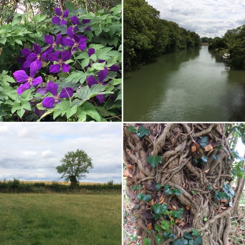
Images from walk on 070719

It was a greyish, muggy morning, and the canal was looking quite muddy (possibly because of recent dredging activity), but the banks were green and full of flowers and there were ducklings, so although it was a short walk it was a pleasant one, and as it was T's first walk in new boots it was probably best to start small.

*5.08 miles, according to Runkeeper. Short by our current standards, at any rate, though it's not that many years since we would have thought that was quite a long walk despite thinking of ourselves as people who generally liked a walk even if we didn't get out for one very often...

**Which was nice, but I do think if you're going to charge £6.95 for avocado toast you could give people two bits of toast, and not just one bit cut in two. Perhaps this is why eating avocado toast is stopping Millenials from being able to afford houses.
white_hart: (Default)
We're off to Scotland again at the end of August, heading back to Fort William to pick up where we left off at the end of the West Highland Way and walk the Great Glen Way to Inverness. In preparation for this (and also because we enjoy it anyway) we've been upping our walking distances, and a few weeks ago we also started talking about the possibility of doing a two-day walk with a night in a B&B to help us get back into the habit of doing long walks on consecutive days. At first the plan was to do a two-day walk, getting the train to Moreton-in-Marsh and walking to Charlbury via an overnight stop in Bourton-on-the-Water, but then we looked more closely at the map and measured distances with a bit of string and realised that it would be perfectly possible to walk home from Charlbury in a day via the Oxfordshire Way and the Oxford Canal towpath, so we extended it to a three-day walk. Unlike our normal multi-day walks, for this one we carried everything with us, but it's not as if three days of walking in high summer require that much in the way of luggage (pyjamas, two spare tops, two pairs of pants, two pairs of socks, deodorant, toothbrush) and although I'm still wondering if my new 30l daypack is slightly too big for a day's walking it was the perfect size for a three-day walk, with enough space to add in my walking sandals so I didn't have to spend the evenings in boots.

ExpandDay 1: Moreton-in-Marsh to Bourton-on-the-Water via Stow-on-the-Wold )

ExpandDay 2: Bourton-on-the-Water to Charlbury )

ExpandDay 3: Charlbury to Kidlington )

Generally, this was a really nice walk along well-maintained and well-signposted paths. It was a great way to relax and unwind after another busy term at work, and it was fun to go away with such minimal luggage and not have to make any decisions at all about what to wear. It also demonstrated that, lovely as Scotland is, it's not always necessary to travel a long way to find adventure or get away from things; Moreton-in-Marsh is only a couple of hours away by public transport, even with the rail replacement bus, and only 20 miles from us by road, and yet we managed a fabulous three days of meandering gently back home and might have been hundreds of miles away for all the thought we gave to home, work and normal life.
white_hart: (Default)
I got the idea for today's walk a few months ago, when our daily events email at work included a pilgrimage from Abingdon Abbey to Oxford via Boar's Hill. I wasn't particularly interested in making an actual pilgrimage, or indeed in doing a work-related thing on a sleety Saturday morning in early March, but I thought the route sounded worth trying, and more interesting than Oxford to Abingdon via the Thames Path, which we did last year and which was pleasant enough but fairly dull, with a long tarmaced stretch from Oxford out to Iffley and vegetation meaning that for much of the walk the river wasn't even visible.

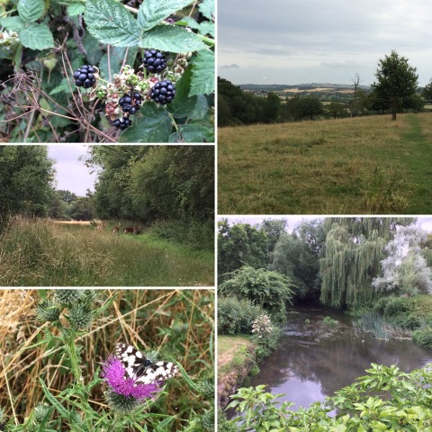
Images from walk on 230619

The British Pilgrimage Trust site claimed that the walk was 12 miles, but we decided that instead of trying to find our way through the northern edge of Abingdon as suggested we might as well just follow the Thames Path round to the Radley boathouse and head inland from there, and our walk ended up being just over thirteen and a half miles. After leaving the Thames Path, we walked up through the grounds of Radley College (me: "This is really weird! It's a school, but it doesn't look like a school!") to cross the road that heads into Abingdon from the north (at which point we realised that fully half the walk had been taken up by making a big loop around Abingdon) and then shortly after that the A34. From there, we walked into the village of Sunningwell where we stopped to eat our sandwiches by the picturesque village pond before heading up the southern slopes of Boar's Hill. We continued to Old Boar's Hill where we met a very friendly cat before walking up to Jarn Mound (where, with the trees in full leaf, the view is completely obscured these days) and then bac into Oxford down the Chilswell Valley and through South Hinksey. Because the BPT directions were rather vague, I abandoned them early on and used the walk as a chance to practice navigating by map alone, which went rather well as we didn't go wrong at all apart from a superfluous circuit of the tennis court in Hinksey Park. It makes an enjoyable walk, and it was nice not to need the car for once as both start and finish are completely accessible by public transport. We heard a cuckoo as we walked along the Thames Path and saw a kestrel taking flight and hovering just after we turned off at Radley.
white_hart: (Default)
The weather looked a bit iffy today, but after a week of wet weather when I hadn't managed to spend nearly enough time outside I didn't want to miss the chance for a walk, so we packed our waterproofs picked another walk from the book of "adventurous" walks, a 12.5-mile circuit of the villages to the south-east of Oxford on either side of the River Thame.

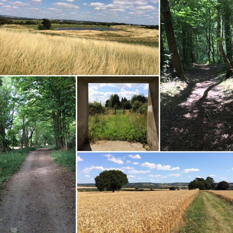
Images from walk on 160619

We didn't get off to the best of starts; I am still quite scared of my new car and find driving it quite stressful, and getting to Stadhampton involves negotiating the Cowley junction of the Oxford ring road which I hate anyway. And then when we got to Stadhampton the parking by the village green which the book recommended had a sign saying it was only for the church and village hall events (from the expressions of the kind people who drove up behind us just after we'd parked outside their house and said it was fine, we didn't need to move, when we mentioned it, I assume a tediously over-zealous parish council getting on their high horse about it). I was also repeatedly annoyed by the chest strap of my new Decathlon backpack popping off the piping it slides up and down several times, and got grumpier and grumpier as it became clear that the problem really was that the bag is not designed for people with busts, as the only way to get the strap to cross above my bust involves positioning it right at the top of the piping, where it pops off as there's a bit of fabric without the cord inside to facilitate removing the strap if needed. It settled down in the end, and before I use it again I might try sewing some seed beads or something at the top of the cord to stop the strap sliding up any higher, but it made me very cross at the time.

However,in the end we only got seriously rained on once, for about ten minutes, and other than that it was dry and even occasionally sunny. The walk climbed from the low-lying Thame Valley onto the southern slopes of the limstone outcrop which forms Shotover and Headington Hills, with broad views south to the Chiltern escarpment and less inspiring views north-west to Oxford, which from this aspect is rather less dreaming spires and more Midlands industrial town, with the dominant features being the BMW plant and the tower blocks and housing of Blackbird Leys. We saw the usual red kites and skylarks, several rabbits as we came down the hill from Garsington, and two roe deer bounding across a field just in front of us between Garsington and Toot Baldon, and eventually the walking worked its magic and I began to feel happier and calmer.

It's not a walk I'd recommend, or one we'll be doing again, though; we encountered far too many fields where the crops had been planted with complete disregard for the paths, which combined with some irritatingly vague directions in the book made it hard to navigate and sometimes hard to get through even when we had worked out where the path was. In one case, it looked for a moment as though we would need to cross a paddock of very frisky young cattle, though fortunately it turned out that we just needed to cross the next-door paddock of slightly less frisky horses; further on, we did have to cross a field of cows with calves which I found an utterly terrifying experience. There were also a lot of very badly maintained stiles. And then we got to a point where we absolutely couldn't see where the path we were meant to be on might be, and after consulting the map decided we must have turned too early, retracted our steps to the path we'd turned off (adding another mile or so to the walk) and carried on, only to find that there wasn't another turning and that must have been the right way after all, but by this point the only sensible thing to do (for some values of sensible) was to walk the mile and a half to Chiselhampton along a fairly busy B-road. This may well have actually counted as adventurous, but if so, it's not the kind of adventure we were thinking of!
Profile

white_hart: (Default)
white_hart

May 2025

S M T W T F S
    123
456789 10
11121314151617
18192021222324
25262728293031

Most Popular Tags

Syndicate

RSS Atom

Style Credit

Page generated Jul. 25th, 2025 08:04 pm
Powered by Dreamwidth Studios