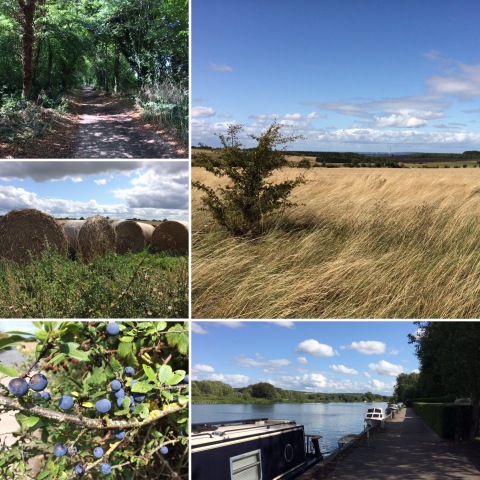
Having finished the Oxfordshire Way, this weekend was back to normal with a 10.5-mile circular walk. This one was from the Ordnance Survey book of circular walks in the Thames Valley and Chilterns, starting at a National Trust car park just outside Streatley and heading out across the Berkshire Downs on the Ridgeway before turning back to reach the Thames Path at Moulsford and following that back to Streatley.

It's strange how different the Downs are to the Chilterns on the other side of the river; instead of the Chiltern beechwoods, the Downs are mostly fields, and where there are woods they're generally mixed rather than beech. Because they're much more open, they can be quite windswept on a breezy day. Today's walk mostly took us along byways rather than footpaths or bridleways, which meant being passed by occasional Landrovers or dirt bikes, and towards the end of the Downs section we also passed a field where there was a motocross event going on, rather noisily, though the earlier part of the walk was very peaceful and the views were glorious (although the absence of the Didcot Power Station cooling towers was rather odd!).
The walk directions made some slightly odd choices, one of which was directing us a short distance down the verge of a fairly busy A-road to join the path to Moulsford, when looking at the map clearly showed that there was a path doubling back downhill just before the byway we were on joined the road and meeting the path we wanted to be on, so we would only have had to cross the road and not walk along it (though it turned out to be possible to get down off the verge into the field margin, which felt a lot safer).
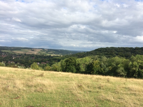
The section of the Thames Path from Moulsford to Streatley turned out to be a particularly pleasant one, and we stopped for a drink and some crisps at the pub in Streatley before tackling the final steep climb up to the car park, for which we were rewarded with a terrific view over the Goring Gap, where the Thames cuts through the chalk to divide the Berkshire Downs from the Chilterns.

Again, this was a point where the book seemed rather odd, mentioning the route we took as an alternative "scenic route" but suggesting that the standard route back to the car park was along the road, which was a moderately busy B-road with no pavements and which climbed fairly steeply, if not as steeply as the path; having driven up it to park, I certainly wasn't going to try walking up it!
All in all, I don't think I liked this walk as much as some we've done, but it had some very pleasant stretches and I probably would do it again at some point.

It's strange how different the Downs are to the Chilterns on the other side of the river; instead of the Chiltern beechwoods, the Downs are mostly fields, and where there are woods they're generally mixed rather than beech. Because they're much more open, they can be quite windswept on a breezy day. Today's walk mostly took us along byways rather than footpaths or bridleways, which meant being passed by occasional Landrovers or dirt bikes, and towards the end of the Downs section we also passed a field where there was a motocross event going on, rather noisily, though the earlier part of the walk was very peaceful and the views were glorious (although the absence of the Didcot Power Station cooling towers was rather odd!).
The walk directions made some slightly odd choices, one of which was directing us a short distance down the verge of a fairly busy A-road to join the path to Moulsford, when looking at the map clearly showed that there was a path doubling back downhill just before the byway we were on joined the road and meeting the path we wanted to be on, so we would only have had to cross the road and not walk along it (though it turned out to be possible to get down off the verge into the field margin, which felt a lot safer).
The section of the Thames Path from Moulsford to Streatley turned out to be a particularly pleasant one, and we stopped for a drink and some crisps at the pub in Streatley before tackling the final steep climb up to the car park, for which we were rewarded with a terrific view over the Goring Gap, where the Thames cuts through the chalk to divide the Berkshire Downs from the Chilterns.

Again, this was a point where the book seemed rather odd, mentioning the route we took as an alternative "scenic route" but suggesting that the standard route back to the car park was along the road, which was a moderately busy B-road with no pavements and which climbed fairly steeply, if not as steeply as the path; having driven up it to park, I certainly wasn't going to try walking up it!
All in all, I don't think I liked this walk as much as some we've done, but it had some very pleasant stretches and I probably would do it again at some point.